Virtual Winds & Weather4D Pro
Next weekend we fly to Porto to move Shearwater down the coast to Gibraltar. It’s roughly 500nm to the rock and a nice chance to try all of the changes we’ve made to Shearwater since arriving in Porto last summer. It shouldn’t come as a surprise that we are already watching the weather given my background (I did weather routing for ships before switching to wind farm design). We’ve been trying out a few things as software has evolved even since last summer, and I think we’ve a nice plan in place to get weather information and do onboard routing.
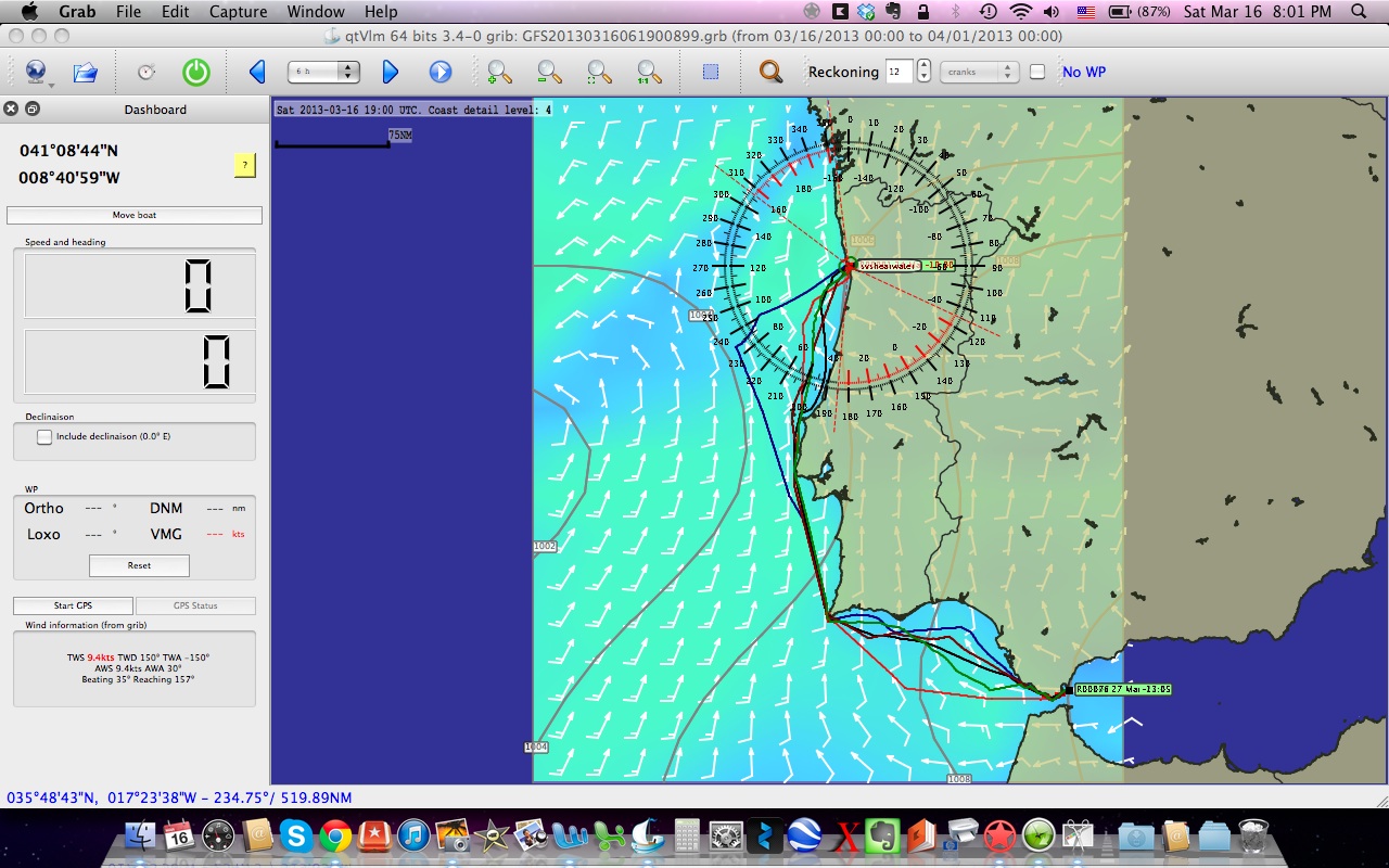
Last summer we used PredictWind as our primary guidance, along with gribs and weather charts, but PredictWind, while quite good, is not cheap. Since then new routing software called Virtual Winds has been developed by a French company and it is free. I’ve been trying it out for several months and all in all I’m pretty pleased with how it works. We’ve set up two subscriptions with Saildocs to receive the 00z and 12z grib files. I’ve uploaded our boat polars into Virtual Winds and then set the efficiency to 85%. I’m not yet sure how reasonable that is, but I hope that for us double-handing, with a fair bit of gear onboard it is pretty close. There is a way to get very accurate polars, but I need to get a small piece of NKE gear to do that properly. Something for later this year.

Virtual Winds
The nice thing about Virtual Winds, or other onboard routing software like Expedition or Adrena ($$$) is that you can run multiple scenarios, varying boat speed (polar efficiency), varying wind speed (% of forecast), or vary the timing of the weather changes if you think the forecast is early or late compared to actual conditions. Running a range of scenarios can provide a route band, which tells you that even if the forecast or performance aren’t spot on, you should still saili within this range of options. That’s pretty helpful and can cut hours or days off of a long voyage.
Once an optimized route is created in Virtual Winds we can export the route as a .gpx file and then the fun starts. It took me several hours today, mostly trying to use Bluetooth to do a file transfer between our MacBook and iThings to discover that all I had to do was create a home wireless network on the MacBook, connect the iThings to the network via wireless and then with a free File Manager app, I can move files back and forth between all of our Apple stuff. That is probably old news to many, but I was jumping for joy in the end, because it is so simple and fast. So with that new bit of knowledge we can export the optimized route .gpx file to one of the iThings running iNavX and load the route on top of a proper chart. Then we can do standard navigation to the waypoints along the optimized route. Yeah boy!
So that is plan A. There is another option that we will keep as plan B. An app called Weather4D just introduced the Pro version which also does weather routing. The obvious appeal of an app, is that it runs on a iPad and in theory doesn’t require the use of a laptop anymore. I love the idea of not needing to pull out a laptop onboard, so I gave Weather4D Pro a try and the results were so-so, hence the plan B option.
Before you can do routing in Weather4D you have to install the iPolar app and download a polar. iPolar uses a pretty basic set of parameters to create a polar and the really frustrating part is that even if you know your boat polars, there is no way to manually enter the values. All I could do was tweak our boats displacement and sail area to get as close to our polars as possible. Once polars are opened in Weather4D and you open a grib file the routing option becomes available. You do have the option of adjusting the polar efficiency and there are two polar tables, one for jib sailing and one for spinnaker sailing, but you can’t adjust the timing or strength of the gribs. It also takes a fair bit longer to calculate an optimized route on our first generation iPad than with the MacBook. In the end though, the optimized routes are pretty similar and it is very simple to open the optimized route in iNavX which eliminates the need for a file transfer via wireless. I’d really like Weather4D Pro to be the best option, but I don’t think it is quite there yet. Maybe a future version will add some functionality to bring it more inline with the laptop routing software and of course iPolar needs to improve or the routing will never work well.
I’ll continue to work with both options here at home and then on our sail to Gibraltar and we’ll see what really works out there on the big blue sea. It is all good practice for Pacific Cup next year.
Sweet, thanks for all of this. Keeping up with the Vendee Globe I found myself trying to understand weather and winds, where it is and where it isn’t. I have been looking at programs and apps to see if there was something, preferably inexpensive, primarily to learn on at the present time, and found those programs a bit scarce. Some are quite expensive but after getting a handle on what they do, I can understand it a little. I’m a pilot and there are some programs on the more expensive side if you want to go that way, typically though, you can get very good programs in a much lower price point.
Here is wishing you a lot of luck in your upcoming adventures!
Buddy – Central Florida